
By Karoun Chahinian
The artistry of cartography was put under a spotlight in the Geographies of Urban Form exhibit at the Ryerson Image Centre’s (RIC) student gallery.
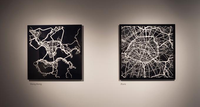
Created by William Davis and Michael Markieta — two alumni of Ryerson masters of spatial analysis program — the exhibit features road networks of 12 iconic cities including Toronto, Seoul, Paris and New York. By combining art and science, the exhibition’s glossed maps focus on “how cities have developed.”
“We decided to collaborate and come up with something that was related to our field, but also artistic,” said Davis. Geographies of Urban Form is the first RIC exhibit created by non-FCAD artists.
Markieta, known for visualizing open data, demonstrated this through his map of global flight networks. Davis, a data analyst at the Toronto Star, also started experimenting with art and geography. The two spent four months interpreting data and stylizing prints for the exhibit. They used OpenStreetMap — a non-profit supporting “development of freely-reusable geospatial data” — to interpret the data and Adobe Illustrator to format it.
“This exhibit gives people cool looking abstract art pieces, but simultaneously say things that are actually quite factual,” said Davis.
Davis’ favourites in the exhibit are Toronto and Seoul, the largest pieces. Toronto was chosen as a tribute to their hometown, while Seoul was favoured for its symmetrical, “visually stunning” urban design developed around the iconic Han River. All 12 cities were forced to build around barriers ranging from hills and rivers to mountains and lakes inherent to the terrain.
Displaying the major cities side by side highlighted stark differences between the metropolises. Davis noted that Western cities are consistent and pre-planned with their grid-like structures, while European cities stray from that uniformity and develop around natural landscapes, making the road networks more abstract and erratic.
RIC student gallery coordinator Sara Angelucci said she was impressed by how well the science-based exhibit resonates a statement beyond mundane facts.
“What’s so amazing about them is that it’s information, but I didn’t know information could be so beautiful,” said Angelucci.
Angelucci said while the pieces are maps of road networks, they share the same capabilities as paintings or other forms of art because of their subjectivity. She said the pieces reminded her of those within the urban landscape, slowly expanding their cities confined to natural barriers around it.
“People start to have a very personal reaction to the [prints], especially if you have been to any of these cities, you then have a unique connection with them,” said Angelucci. “I was in Hong Kong recently and that made me look at the print in a completely different way. Instead of a geographical map, I thought of my experience exploring that place.”
The exhibit is at the RIC until Nov. 8.


Leave a Reply