By Vjosa Isai and Badri Murali
What started as an idea in an undergraduate computer science class for an incentive-based carpooling application in 2011 is now the basis of an innovative framework called CAVALIS.
Sanjeevan Sivapalan came up with this idea and now works with former classmates Corey McGrillis and Steven D’Costa to make navigation and transportation friendlier for the general public. CAVALIS, which stands for Context-Aware Vehicular and Logistics Information Systems, is a Digital Media Zone (DMZ) incubated idea that works under another startup named Flybits.
CAVALIS connects information from front-line workers (like snow plow operators) to the average commuter and motorist.
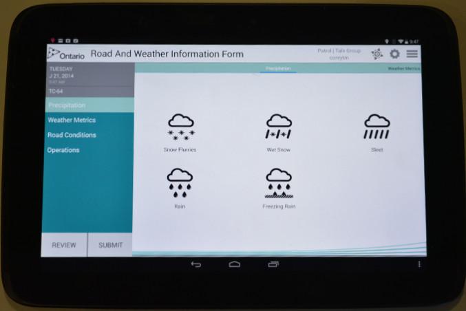
The focus of CAVALIS is based on making traveller information services more accessible to drivers and commuters. The existing system relies on front-line workers to fill in a form with road and weather conditions and to call radio operators through walkietalkies.
The operators take in the information and enter this data, which is sent back to the workers and then uploaded to the Government of Ontario’s public website.
The idea was presented to the Ministry of Transportation (MTO) in 2011 and garnered interest from the Government of Ontario to work with Ryerson and eight other schools. This process took place in three phases.
The first in 2011 involved eight universities, including the University of Waterloo and Wilfrid Laurier University. However, only Ryerson was selected to continue with the second phase in 2012. In that time, the team successfully created a prototype for the MTO.
Now in the third phase, CAVALIS is working to remove any issues and kinks to ensure a marketable product for consumers.
For many residents of the GTA and beyond, CAVALIS allows commuters to receive all the information they need in one place. Users can learn about any traffic and transit delays as they drive to a GO Transit or TTC station. It also provides weather and news updates that may affect travel routes.
This is an example of cloud computing, which refers to numerous devices that connect and communicate with each other through networks using the Internet. While there are many individual apps for each condition (traffic, weather and transit), what matters is that all of this information is connected and easily accessible to the public.
Cloud computing allows the user to access the various apps through one medium. The MTO ran a trial of CAVALIS last year in York and Durham regions, where they tested the app to report road conditions.
“The results were successful,” Mike Burnett, an engineer and project manager at the MTO’s Intelligence Transportation Systems (ITS), said. “We were very happy with the layout and usability of the application and the prospect for improving the efficiency.”
When asked if CAVALIS would have been useful in December’s ice storm, Burnett stressed that “the application is not geared at response times. It’s about reporting more timely information back to the public on road conditions.”
Burnett observed that the project was well-received and said that ITS hopes to continue pursuing product-type research as an alternative to written reports and to inform the public sooner.
For D’Costa, the opportunity to go straight to work after school has been beneficial. “I don’t have to just say I learned something, I can show that I have worked on something,” D’Costa said. “I have a portfolio and a degree.”
D’Costa envisions CAVALIS as playing a role in making Toronto a smart city that will be faster at distributing information to the public through wireless networks and mobile apps. The goal is to fully harness communications technology and the CAVALIS framework is just one step in a larger process.
For now the team is continuing to work under the supervision of Hossein Rahnama, research director of the DMZ, to make CAVALIS ready for the market later this year.


Leave a Reply